By Dr. Saber Miresmailli, ecoation Founder and CEO
Alongside the announcement of ecoation’s newly patented KENNIS Grower Assistant platform, we also introduced the concept of stereo-spatiotemporal measurements and crop intelligence. But what exactly does stereo-spatiotemporal mean? Collecting temporal data is a common industry practice, with various sensors fixed in place to collect different types of data over time, you can build trends of change over the temporal dimension. In recent years, some companies have attempted to collect spatial data, meaning data collected over space. ecoation has been one of the pioneers of collecting spatial data, measuring environmental conditions from every square meter of greenhouse in order to check crop health, assess yield and monitor crop work.
Spatial data has an advantage over temporal data in the sense that the information can represent the entire area under surveillance and not just a sample spot where a fixed sensor is gathering temporal data. The disadvantage of spatial data is that with a moving sensor, you can be in one location only at one time and you are unable to see the change over time. When you are able to combine the two, as ecoation has accomplished, you can collect spatiotemporal data which not only shows the change in every square meter of the area but can create trend of change over time in each unit of space. ecoation has built and patented sophisticated algorithms that can take the effect of time out of spatial data and build change trends that are on par or even better.
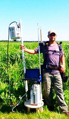
Dr. Saber Miresmailli at Energy Farm, Illinois, USA.
But we didn’t stop there! There is another dimension that plays an important role in the behaviour of the crops when it comes to environment and wellbeing: the canopy height. More than a decade ago, while I was conducting my postdoctoral studies at the University of Illinois at Urbana-Champaign, I used Eddy Covariance technique to perform atmospheric measurement in order to understand vertical fluxes of plant biogenic organic volatiles in the context of induced defence (pictured right). This technique is used for gathering flux measurements in various contexts and it represents flow of air in various atmospheric boundary layers. Equipped with the knowledge of global atmospheric measurement across vast ecosystems, I started to look closely into the existing climate boundary layers that exist in the greenhouse. It is true that we artificially remove many elements that can induce change in order to establish a uniform climatic conditions inside the greenhouse, yet in the large facilities, it is not possible to create a completely homogeneous environment at all times. To measure conditions at only one place, whether temporally via fixed sensors or spatially via mobile sensors, will only give you the conditions at, well, one location! For many fixed sensors, that won’t represent any part of the canopy where the sensors aren’t installed. The solution is to expand the measurement of the flux beyond just a point of data. This is why we introduced stereo-spatiotemporal measurement.
A lot of people associate “stereo” with sound as in left and right or vision (similar concept). However, the term stereo is also used in the context of chemistry, as in stereochemistry. In this context, the prefix stereo means three-dimensionality. By measuring environmental and light conditions at the root zone as well as upper canopy, we can measure the flux of change in three dimensions: vertically across the canopy, horizontally across the rows of plants, and temporally at different times of the day. Given this three-dimensionality, stereo-spatiotemporal measurement is capable of yielding insights at a per cubic meter granularity. Each greenhouse is a vibrant living ecosystem with non-stop tri-trophic interactions between plants, pests/diseases and beneficials. The ultimate goal is to maintain the crop balance, maximize production and maintain consistency of the desirable traits. With this new insight, growers can better adjust their crop work (i.e. optimized de-leafing schedule to adjust RH% level or adjust lowering and distance between the heads of the plants to optimize light penetration to the canopy), adjust IPM programs (i.e. where to deploy bios and adjust the rate of application to save cost on material and labour and better understand bios population dynamics), and adjust physical structure of greenhouse (i.e. distance of the lights to the canopy, scheduling of the fans and their speed, scheduling of the misters, etc). When used with the KENNIS Grower Assistant platform, this information can provide insight into why certain areas of the greenhouse perform better than the other areas and what elements needs to be adjusted to reach the desired outcome.
As the saying goes, “Knowledge is Power”. This new method of data collection, combined with the novel KENNIS Grower Assistant AI / IA platform, produces a very powerful decision support system (DSS) that can be used in various aspects of greenhouse management.
Dr. Saber Miresmailli
Founder and CEO
Ecoation Innovative Solutions Inc.